East Antarctica's Denman Glacier has retreated almost 3 miles over last 22 years
UCI, NASA scientists assess ice sheet with potential to raise global sea levels nearly 5 feet
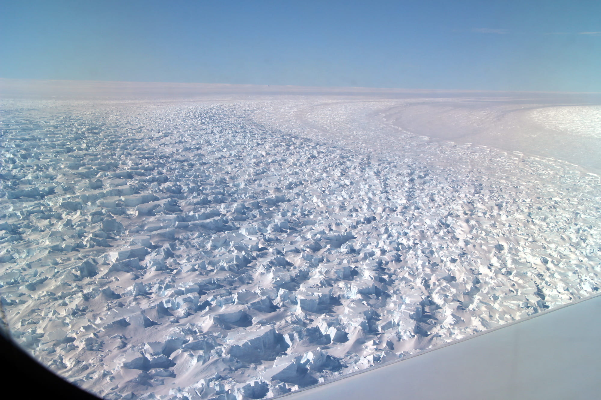
Irvine, Calif., March 23, 2020 – East Antarctica’s Denman Glacier has retreated 5 kilometers, nearly 3 miles, in the past 22 years, and researchers at the University of California, Irvine and NASA’s Jet Propulsion Laboratory are concerned that the shape of the ground surface beneath the ice sheet could make it even more susceptible to climate-driven collapse.
If fully thawed, the ice in Denman would cause sea levels worldwide to rise about 1.5 meters, almost 5 feet. With this sobering fact in mind, the UCI and NASA JPL scientists have completed the most thorough examination yet of the glacier and surrounding area, uncovering alarming clues about its condition under further global warming.
The team’s assessment is the subject of a paper published today in the American Geophysical Union journal Geophysical Research Letters.
“East Antarctica has long been thought to be less threatened, but as glaciers such as Denman have come under closer scrutiny by the cryosphere science community, we are now beginning to see evidence of potential marine ice sheet instability in this region,” said co-author Eric Rignot, chair, Donald Bren Professor and Chancellor’s Professor of Earth system science at UCI.
“The ice in West Antarctica has been melting faster in recent years, but the sheer size of Denman Glacier means that its potential impact on long-term sea level rise is just as significant,” he added.
According to the study, Denman Glacier experienced a cumulative mass loss of 268 billion tons of ice between 1979 and 2017.
Using radar interferometer data from the Italian Space Agency’s COSMO-SkyMed satellite system, the researchers more precisely determined Denman’s grounding line, the point at which the ice leaves the land and begins to float in the ocean.
“Differential synthetic aperture radar interferometer data from 1996 to 2018 showed us a marked asymmetry in the grounding line retreat at the ice sheet’s land-sea interface,” said lead author Virginia Brancato, a postdoctoral fellow with NASA JPL who was a postdoctoral scholar at UCI when the study was conducted.
Denman’s eastern flank is protected from retreat by a subglacial ridge. But Brancato said that the western flank, which extends roughly 4 kilometers, is characterized by a deep and steep trough with a bed slope conducive to accelerated retreat.
“Because of the shape of the ground beneath Denman’s western side, there is potential for rapid and irreversible retreat, and that means substantial increases in global sea levels in the future,” she said.
In December, Nature Geoscience published a paper on the BedMachine Antarctica project led by Mathieu Morlighem, UCI associate professor of Earth system science, which revealed that the trough beneath Denman Glacier extends 3,500 meters below sea level, making it the deepest land canyon on Earth.
The UCI and NASA JPL scientists report in the Geophysical Research Letters paper that the bed configuration of Denman is unique in Antarctica’s eastern sector. Other major glaciers, such as Totten and Moscow University, feature prograde beds that slope down in the flow direction, providing some measure of stability, Rignot said.
Tracking the state of the floating extension of Denman Glacier, a 24,000-square-kilometer mass that includes the Shackleton Ice Shelf and Denman ice tongue, will be especially important, he added. The researchers used the German Aerospace Center’s TanDEM-X satellite in combination with data from COSMO-SkyMed to assess the melt rate of the floating sea ice, learning that the Denman ice tongue has shed mass at a rate of about 3 meters per year, above average compared to other East Antarctic ice shelves.
“We need to collect oceanographic data near Denman and keep an eye on its grounding line,” Rignot said. “The Italian COSMO-SkyMed satellite system is the only tool for us to monitor grounding line conditions in this sector of Antarctica, and we are fortunate to have on our team Dr. Brancato, who is skilled in extrapolating the data to give us the precise and up-to-date information we require.”
This project was funded by NASA’s Cryospheric Sciences Program and received support from the Italian Space Agency and the German Aerospace Center. Data and bed topography maps are publicly available at https://doi.org/10.15146/zf0j-5m50.
About the University of California, Irvine: Founded in 1965, UCI is the youngest member of the prestigious Association of American Universities. The campus has produced three Nobel laureates and is known for its academic achievement, premier research, innovation and anteater mascot. Led by Chancellor Howard Gillman, UCI has more than 36,000 students and offers 222 degree programs. It’s located in one of the world’s safest and most economically vibrant communities and is Orange County’s second-largest employer, contributing $5 billion annually to the local economy. For more on UCI, visit www.uci.edu.
Media access: Radio programs/stations may, for a fee, use an on-campus ISDN line to interview UCI faculty and experts, subject to availability and university approval. For more UCI news, visit wp.communications.uci.edu. Additional resources for journalists may be found at communications.uci.edu/for-journalists.

