Rising waters
UCI students help coastal communities brace for climate change
UC Irvine undergraduates Tristan Lanza and Enrique Uribe have been catching the bus regularly from campus down to Newport Beach to knock on doors. Lanza, 21, noticed the first time they neared the coast right where flooding would likely begin.
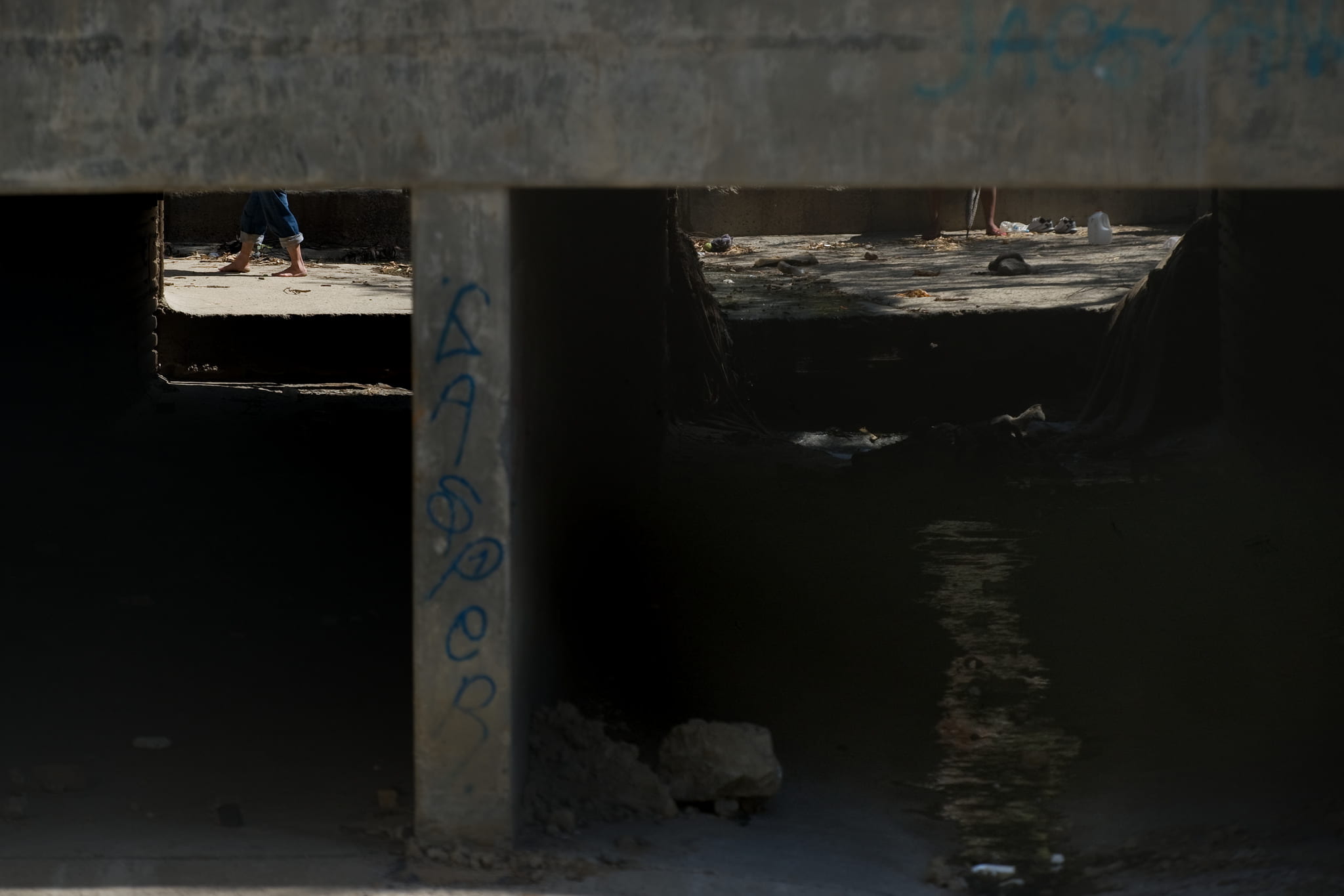
Back in UCI’s Engineering Tower, graduate student Adam Luke, 23, pores over computerized hydraulic models that he has spent weeks constructing of the Tijuana River estuary straddling the U.S.-Mexico border. This is where flooding would hit hardest, he thinks, gazing at a destitute Mexican canyon community. And here, he notes, taking stock of Imperial Beach on the U.S. side, is where higher king tides combined with fiercer storms could swamp several streets.
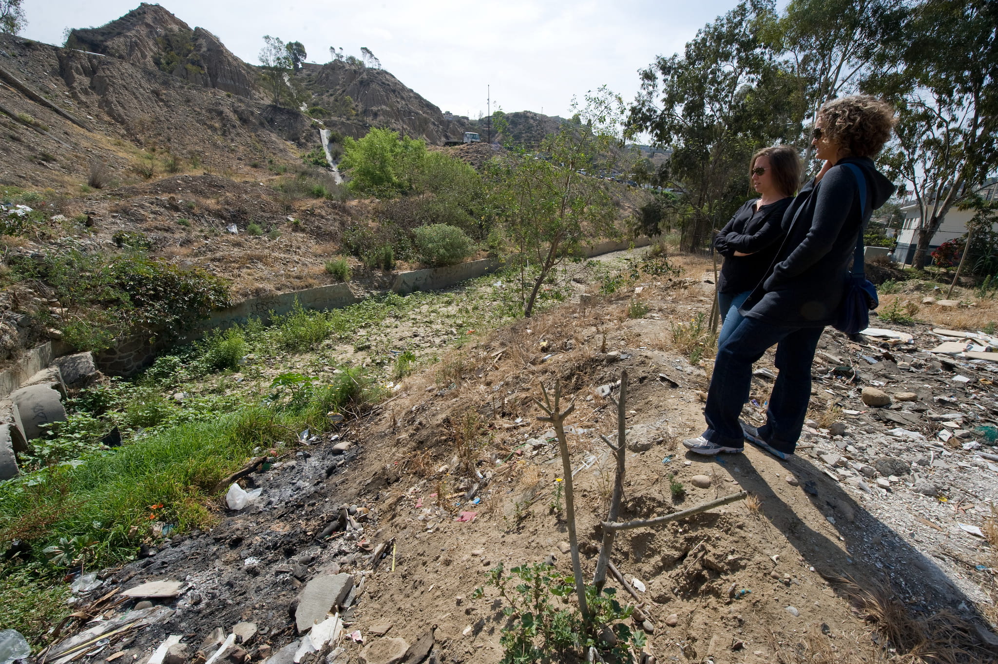
Two hours south, social ecology doctoral student Kristen Goodrich, 30, is at the wheel of a white van, driving carefully up a rutted street in one of Tijuana’s poorest neighborhoods. She snaps a photo of ramshackle homes accessed by rickety footbridges. “How would these people get out if water washed out those bridges?” she wonders.
Students of all levels and from many disciplines of UC Irvine are participating in the Flood-Resilient Infrastructure & Sustainable Environments – or FloodRISE – project, a $2.8 million, four-year interdisciplinary effort funded by the National Science Foundation. The aim is to help communities along the California coast and Tijuana River Estuary better understand and cope with rising waters and stronger storms from climate change. They and their professors are sitting at strangers’ kitchen tables, crawling through culverts and using low-flying plane data to tackle the task.
“Climate change is the biggest challenge of my lifetime, and there’s a lot that needs to done besides reducing emissions,” says Uribe, 22, a senior graduating this week with a bachelor’s degree in political science. “This project is going to have very significant impacts, helping people in communities who are most at risk.”
Abigail Reyes, director of UCI’s Academic Sustainability Initiatives, is leading the FloodRISE integration and impact team. “It’s our responsibility as a public research institution to train our students to respond to environmental justice and social justice crises at the scale and pace necessary to turn the tide,” she says.
Civil & environmental engineering chair and professor Brett Sanders had the idea to provide the public with more precise risk estimates than overly broad or outdated FEMA maps. But he didn’t want to just come up with numbers. He approached Richard Matthew, professor of planning, policy & design, and they devised a strategy to develop climate-related flood models on a house-by-house basis, to inform potentially affected residents and local policymakers without panicking them and to help with possible solutions, from building higher seawalls to relocating if necessary.
“We’re working to help communities manage risk. Engineers spend considerable time developing models of flooding, but we need to do a better job communicating the results,” Sanders says. “Every community has different demographics, different economics, different factors of so many kinds. Standard engineering courses offer highly specialized skills for hydrologic analysis, and FloodRISE broadens that context to also offer something very valuable to real people.”
FloodRISE Hazard Scholars like Lanza and Uribe earned course credit for conducting baseline surveys of residents in low-lying Newport Beach. They began their polling during a record-breaking heat wave in May, when the possibility of waves crashing into homes seemed remote. But both grew up in tropical Central America and have seen the costly, sometimes deadly effects of hurricanes and other extreme weather.
“As soon as I heard about the project from a professor I thought of home,” says Lanza, an urban studies major with a minor in urban and regional planning from Belize City. Lanza’s parents have sometimes had to close their business because of heavy rains and inadequate municipal runoff infrastructure.
An avid surfer, Uribe lives in a house with other students in in Newport Beach and has seen some minor storm drain flooding, but nothing like the crushing 2010 mudslides that killed 23 people not far from his home in Costa Rica.
Uribe says he was nervous about approaching people he didn’t know, but he’s been amazed at the response. They’ve had good luck persuading many folks to spend 30 to 40 minutes answering questions on everything from how often they’ve experienced floods to how much income they earn to how they would escape a natural disaster.
“We actually have a tablet we give them so they can punch in which roads they think they would use to evacuate,” says Lanza. “It’s a pretty cool interactive piece.”
“The students are passionate, they’re engaged and they understand that what they’re doing is of immense importance,” Matthew says. “They are showing a type of poise that’s very impressive, stepping up to the role of being our ambassadors, knocking on strangers’ doors, which is not easy, and asking the necessary questions.”
Longtime Balboa Island resident Lee Sutherland was the first person surveyed by the UCI team.
“I think it’s great. The more information we can get the better. We need it,” says Sutherland, a retired aerospace engineer who has lived on the bay since 1991. “When we bought our property, we didn’t even think about global warming … but we need to think about it now.”
He can’t wait to see the improved flood risk maps that UCI is developing.
Much of that work is being done by Luke, who arrived in 2013 from Ohio and is studying for a master’s degree in civil & environmental engineering. He’s thrilled with the FloodRISE project, which builds on modeling work he did as an undergraduate in the Midwest.
Traditional flood maps are outdated because they rely on relatively crude Geographic Information Systems data and older, simplistic computer models. But new LIDAR (light detection and radar) techniques and advanced computer models offer higher resolution, fully three-dimensional representations of rivers and their floodplains. That means rather than regional maps showing areas that could end up either inside or outside a flood zone, Luke can model how the height and velocity of waters in a particular flood channel will rise by the minute during a storm. But LIDAR costs more, and it can take as long as a week to draft a single model.
For him, the field trips and painstaking computer work are worth it. Both sea levels and intensity of rainstorms are predicted to increase as a result of changing climate in California.
“We can help people with this information,” he says. The toughest conclusion he’s made so far is what could happen to poor people least equipped to handle floods in Tijuana’s Los Laureles Canyon. “All these homes would be washed out in a hundred-year-flood,” he says, pointing to parcels clustered at the bottom of steep road embankments on one side, and a badly eroded riparian zone on the other.
Sanders says Luke is “a wonderful student. The impact he has had in his first year is truly remarkable.”
“Our mission here is to educate students, don’t forget,” he adds. “We want them to take their data and be able to explain the results in a simple way to aid decision-making in the context of real flooding, whether it’s in Tijuana or Newport Beach or New Orleans or Bangladesh.”
Goodrich has grown increasingly interested in “the human dimension” of climate change. She has been a program coordinator at the Tijuana River National Estuarine Research Reserve for the last five years. But she decided to return to school for a doctorate in social ecology to build her research skills and broaden her perspective, augmenting her community partnerships and action-oriented research ethic. She looks to solutions that could enhance environmental protection and human security, like restoring natural wetlands as buffers that will benefit not just wildlife, but humans.
“I look out over the reserve across the border and see opportunities for co-benefits,” she says. “I hope that by studying and protecting one of the largest remaining wetlands in Southern California, we can also protect the people who live next to it.”
Uribe agrees that human activity, which is causing rising seas, could also provide answers: “My father says we all call it ‘el planeta Tierra’ – planet Earth – but it’s mostly water, so we should call it ‘el planeta oceano’ – planet ocean. If we take care of the ocean, we will be taking care of ourselves.”